Unmanned Aerial Vehicle (UAV) Surveys
From remote, abandoned mine lands to archaeological sites and Cultural Resources documentation, UAV surveys offer an efficient, safe, and economical means of generating the information you need for decision-making and documentation. Our UAV surveys:
— Are conducted by Federal Aviation Administration (FAA) certified pilots
— Can generate terrain data more efficiently and comprehensibly than traditional surveys in most cases
— Provide detailed aerial images in addition to terrain data
— Can generate 3-dimensional models that allow you to evaluate the site from all angles and make better decisions from the desktop
— Reduce the health & safety hazards inherent in ground surveys on steep and/or unstable terrain
— Reduce habitat and cultural feature disturbance resulting from foot traffic in sensitive environments
Terrain Mapping Examples
UAV surveys facilitate the rapid assessment of landscapes, providing information that in many cases would be impossible, or too costly or unsafe to obtain from pedestrian surveys alone. The assessment of abandoned mine lands (AMLs) is one such application. AML sites are often located in remote and unstable environments that can make more than a cursory evaluation unfeasible; however, with a single flight our team can generate: detailed topographic maps; digital elevation models; georeferenced, high-resolution photographs; 3-Dimensional models; and, in many cases, accurately estimate other relevant information, including tailings pile volumes and runoff patterns. The aerial imagery also provides a powerful tool for visually communicating nearly real-time status information to stakeholders, decision-makers, and regulators. Site planning/scoping, remedial cost estimation, and site prioritization/ranking between different sites will all be enhanced.
Abandoned Mine Area
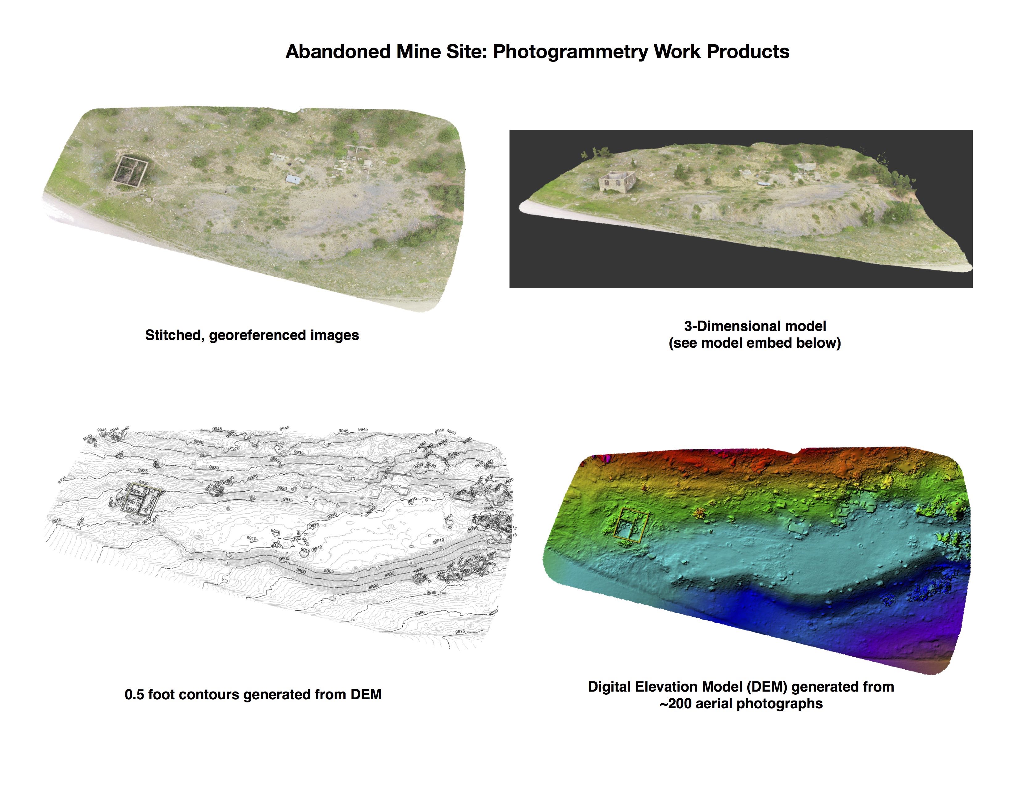
3-Dimensional model of abandoned mine site generated from photogrammetry
Cultural Resources Documentation Examples
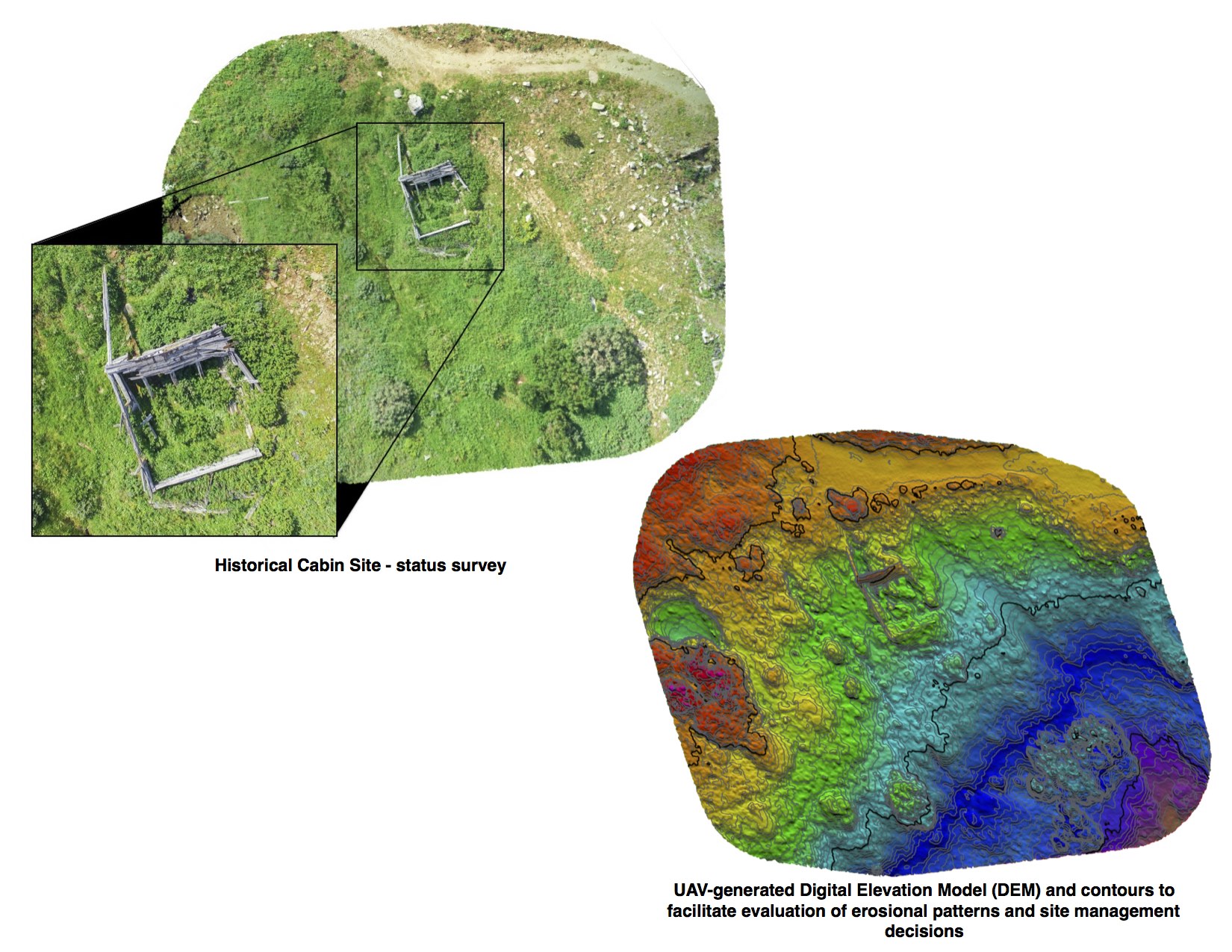
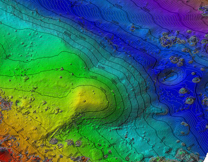
UAV surveys provide an efficient means of documenting cultural resources for a variety of academic purposes, and for meeting the requirements of Sections 106 and 110 of the National Historic Preservation Act (NHPA). In many environments, systematic transect surveys can be completed more efficiently and safely using UAV data to assist field workers and augment pedestrian surveys. The technology can also provide data from areas that cannot be physically or safely reached on foot or without damaging the resource. The perspective gained by aerial imagery and terrain data also provide a more comprehensive determination of regional site context and importance, which facilitates landscape-level surveys.
The UAV work products already generated from the survey then provide powerful decision-making and planning tools if the cultural resources survey determines that project mitigation is required. 3-Dimensional models provide an eye-catching and often powerful tool for remote study of the site as well as educational outreach and interpretive programs.
Archaeological Site Located at 16,000 feet elevation in Peru
3-Dimensional model of archaeological site generated from photogrammetry
Cultural Resources Documentation